Make a donation
Gear up for your next adventure:
As an Amazon Associate, this site earns from qualifying purchases at no extra cost to you.
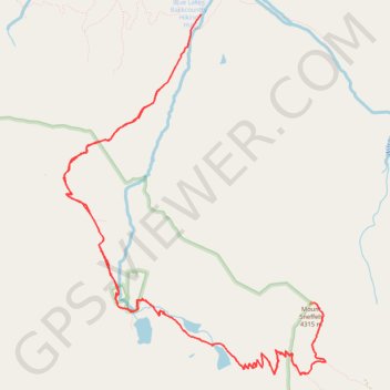
Mount Sneffels via Blue Lakes
Interactive trail map
Make a donation
Gear up for your next adventure:
As an Amazon Associate, this site earns from qualifying purchases at no extra cost to you.
Trail profile
- Distance: 13.3 mi
- Elevation gain: 1,665 m
- Maximum elevation: 4,267 m
- Elevation loss: 1,665 m
- Minimum elevation: 2,857 m
Make a donation
Gear up for your next adventure:
As an Amazon Associate, this site earns from qualifying purchases at no extra cost to you.
About this trail
Name: Mount Sneffels via Blue Lakes trail, distance, elevation, map, profile, GPS track
Start: Dallas Trail, Ouray County, Colorado, United States (38.03453 -107.80724)
End: Dallas Trail, Ouray County, Colorado, United States (38.03451 -107.80727)
Coordinates: 37.99594 -107.82583 38.03453 -107.79025
Make a donation
Gear up for your next adventure:
As an Amazon Associate, this site earns from qualifying purchases at no extra cost to you.
Other hiking, mountain biking, running and outdoor activity trails
Click on a trail to view its statistics, map and profile.
Blue Lakes Trail in Mount Sneffels Wilderness
United States > Colorado > Ouray County
The Lower, Middle and Upper Blue Lakes Trail in the Mount Sneffels Wilderness offers an enchanting journey through dense forests, alpine meadows, and steep switchbacks, ultimately revealing a trio of vivid turquoise lakes cradled by towering peaks. Along the way, hikers are treated to sights like cascading…
Distance: 9.1 mi • Elevation gain: 808 m • Maximum elevation: 3,572 m