Blue Lakes Trail in Mount Sneffels Wilderness
The Lower, Middle and Upper Blue Lakes Trail in the Mount Sneffels Wilderness offers an enchanting journey through dense forests, alpine meadows, and steep switchbacks, ultimately revealing a trio of vivid turquoise lakes cradled by towering peaks. Along the way, hikers are treated to sights like cascading waterfalls, fields of wildflowers, and the impressive silhouettes of Mount Sneffels and Dallas Peak. Despite its popularity and occasional steep sections, the trail’s rewarding views and tranquil lake settings make it a memorable adventure for those seeking solitude and natural beauty. #Hiking #Mountain #Forest #Nature #Lake
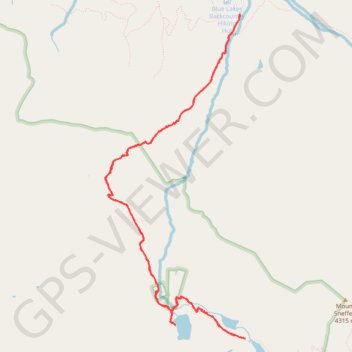
- Distance: 9.1 mi
- Elevation gain: 808 m
- Maximum elevation: 3,572 m
- Elevation loss: 808 m
- Minimum elevation: 2,853 m
- Moving time: 4 h 43 m
- Moving speed: 1.9 mph
- Maximum speed: 5.7 mph
- Total time: 5 h 33 m
- Global speed: 1.6 mph
Interactive trail map
Trail profile
- Distance: 9.1 mi
- Elevation gain: 808 m
- Maximum elevation: 3,572 m
- Elevation loss: 808 m
- Minimum elevation: 2,853 m
- Moving time: 4 h 43 m
- Moving speed: 1.9 mph
- Maximum speed: 5.7 mph
- Total time: 5 h 33 m
- Global speed: 1.6 mph
About this trail
Name: Blue Lakes Trail in Mount Sneffels Wilderness trail, distance, elevation, map, profile, GPS track
Start: East Dallas, Ouray County, Colorado, United States (38.03513 -107.80695)
End: East Dallas, Ouray County, Colorado, United States (38.03534 -107.80699)
Coordinates: 37.99946 -107.82587 38.03541 -107.80608
Other hiking, mountain biking, running and outdoor activity trails
Click on a trail to view its statistics, map and profile.