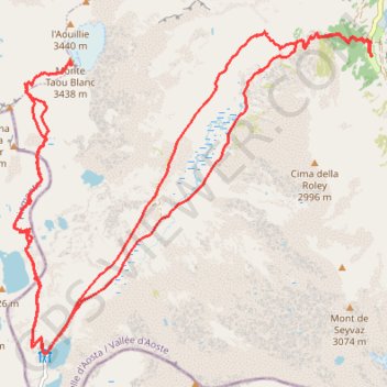
Taoublanc
- Distance: 18.4 mi
- Elevation gain: 1,655 m
- Maximum elevation: 3,414 m
- Elevation loss: 1,658 m
- Minimum elevation: 1,959 m
- Moving time: 7 h 24 m
- Moving speed: 2.5 mph
- Maximum speed: 4.7 mph
- Total time: 9 h 24 m
- Global speed: 2.0 mph
Interactive trail map
Trail profile
- Distance: 18.4 mi
- Elevation gain: 1,655 m
- Maximum elevation: 3,414 m
- Elevation loss: 1,658 m
- Minimum elevation: 1,959 m
- Moving time: 7 h 24 m
- Moving speed: 2.5 mph
- Maximum speed: 4.7 mph
- Total time: 9 h 24 m
- Global speed: 2.0 mph
About this trail
Name: Taoublanc trail, distance, elevation, map, profile, GPS track
Coordinates: 45.48591 7.13816 45.52577 7.20107
Other hiking, mountain biking, running and outdoor activity trails
Click on a trail to view its statistics, map and profile.
PT23DS2 Lörrach → Cadaqués
Germany > Baden-Württemberg > Landkreis Lörrach > Lörrach (Kernstadt)
Distance: 652.9 mi • Elevation gain: 13,130 m • Maximum elevation: 1,505 m