Import a GPX file

Lörrach (Kernstadt) trails

Click on a trail to view its statistics, map and profile.
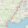
PT23DS2 Lörrach → Cadaqués

Germany > Baden-Württemberg > Landkreis Lörrach > Lörrach (Kernstadt)

Distance: 652.9 mi • Elevation gain: 13,130 m • Maximum elevation: 1,505 m

Gear up for your next adventure:

🗺️Topographic Maps - Detailed maps showing elevation and terrain features
👟Men's Trail Running Shoes - Lightweight grip for fast movement over topographic contours
🧥Waterproof Hiking Jackets - Rain protection for walking in all weather conditions
🐕Dog Hiking Gear - Equipment for hiking safely with dogs
👖Convertible Hiking Trousers - Versatile zip-off pants for changing mountain weather conditions

As an Amazon Associate, this site earns from qualifying purchases at no extra cost to you.