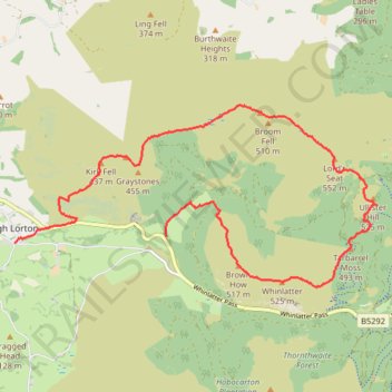
Whinlatter horseshoe route
- Distance: 7.9 mi
- Elevation gain: 519 m
- Maximum elevation: 542 m
- Elevation loss: 660 m
- Minimum elevation: 94 m
- Moving time: 3 h 11 m
- Moving speed: 2.5 mph
- Maximum speed: 8.0 mph
- Total time: 3 h 49 m
- Global speed: 2.1 mph
Interactive trail map
Trail profile
- Distance: 7.9 mi
- Elevation gain: 519 m
- Maximum elevation: 542 m
- Elevation loss: 660 m
- Minimum elevation: 94 m
- Moving time: 3 h 11 m
- Moving speed: 2.5 mph
- Maximum speed: 8.0 mph
- Total time: 3 h 49 m
- Global speed: 2.1 mph
About this trail
Name: Whinlatter horseshoe route trail, distance, elevation, map, profile, GPS track
End: Low Lorton, High Lorton, Lorton, Cumberland, England, CA13 9UL, United Kingdom (54.61760 -3.30074)
Coordinates: 54.61224 -3.30074 54.63426 -3.22498
Topography: Cumberland topographic map, elevation, terrain