McCormick Peak
- Distance: 2.8 mi
- Elevation gain: 276 m
- Maximum elevation: 2,258 m
- Elevation loss: 430 m
- Minimum elevation: 1,827 m
- Moving time: 1 h 17 m
- Moving speed: 2.1 mph
- Maximum speed: 14.4 mph
- Total time: 1 h 43 m
- Global speed: 1.6 mph
Interactive trail map
Trail profile
- Distance: 2.8 mi
- Elevation gain: 276 m
- Maximum elevation: 2,258 m
- Elevation loss: 430 m
- Minimum elevation: 1,827 m
- Moving time: 1 h 17 m
- Moving speed: 2.1 mph
- Maximum speed: 14.4 mph
- Total time: 1 h 43 m
- Global speed: 1.6 mph
About this trail
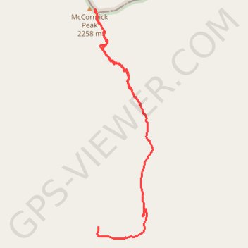
Name: McCormick Peak trail, distance, elevation, map, profile, GPS track
Start: Missoula County, Montana, United States (47.20028 -114.44936)
End: Missoula County, Montana, United States (47.19016 -114.45434)
Coordinates: 47.18913 -114.45473 47.20824 -114.44765
Other hiking, mountain biking, running and outdoor activity trails
Click on a trail to view its statistics, map and profile.
Gravel Loop Ride between Hewolf Mountain and Flathead River
United States > Montana > Lake County
Distance: 55.0 mi • Elevation gain: 1,916 m • Maximum elevation: 1,889 m
McCormick Peak area
United States > Montana > Missoula County
Distance: 27.3 mi • Elevation gain: 1,350 m • Maximum elevation: 1,898 m