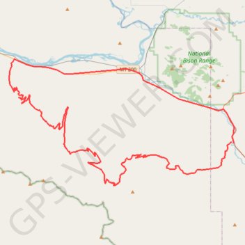
Gravel Loop Ride between Hewolf Mountain and Flathead River
- Distance: 55.0 mi
- Elevation gain: 1,916 m
- Maximum elevation: 1,889 m
- Elevation loss: 1,923 m
- Minimum elevation: 763 m
- Moving time: 5 h 39 m
- Moving speed: 9.7 mph
- Maximum speed: 35.0 mph
- Total time: 6 h 42 m
- Global speed: 8.2 mph
Interactive trail map
Trail profile
- Distance: 55.0 mi
- Elevation gain: 1,916 m
- Maximum elevation: 1,889 m
- Elevation loss: 1,923 m
- Minimum elevation: 763 m
- Moving time: 5 h 39 m
- Moving speed: 9.7 mph
- Maximum speed: 35.0 mph
- Total time: 6 h 42 m
- Global speed: 8.2 mph
About this trail
Name: Gravel Loop Ride between Hewolf Mountain and Flathead River trail, distance, elevation, map, profile, GPS track
Start: 66701, North Valley Creek Road, Lake County, Montana, 59821, United States (47.24761 -114.17301)
End: 99, North Valley Creek Road, Lake County, Montana, 59821, United States (47.24700 -114.17036)
Coordinates: 47.20679 -114.48419 47.32625 -114.16751
Other hiking, mountain biking, running and outdoor activity trails
Click on a trail to view its statistics, map and profile.
McCormick Peak
United States > Montana > Missoula County
Distance: 2.8 mi • Elevation gain: 276 m • Maximum elevation: 2,258 m