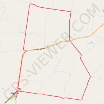
Kumbia to Benair loop
- Distance: 18.9 mi
- Elevation gain: 273 m
- Maximum elevation: 547 m
- Elevation loss: 273 m
- Minimum elevation: 444 m
- Moving time: 1 h 40 m
- Moving speed: 11.3 mph
- Maximum speed: 32.3 mph
- Total time: 1 h 47 m
- Global speed: 10.6 mph
Interactive trail map
Trail profile
- Distance: 18.9 mi
- Elevation gain: 273 m
- Maximum elevation: 547 m
- Elevation loss: 273 m
- Minimum elevation: 444 m
- Moving time: 1 h 40 m
- Moving speed: 11.3 mph
- Maximum speed: 32.3 mph
- Total time: 1 h 47 m
- Global speed: 10.6 mph
About this trail
Name: Kumbia to Benair loop trail, distance, elevation, map, profile, GPS track
Start: Bunya Highway, Kumbia, South Burnett Regional, Queensland, Australia (-26.69206 151.65265)
End: Bunya Highway, Kumbia, South Burnett Regional, Queensland, Australia (-26.69208 151.65263)
Coordinates: -26.69708 151.65244 -26.61439 151.72665
Other hiking, mountain biking, running and outdoor activity trails
Click on a trail to view its statistics, map and profile.
Goodger to Ellesmere and Archookoora State Forest
Goodger, Brooklands, Ellesmere, Haly Creek, Archookoora, Queensland
Distance: 29.7 mi • Elevation gain: 622 m • Maximum elevation: 551 m
Taabinga and Wattle Grove
Australia > Queensland > Kingaroy
Kingaroy, Taabinga, Inverlaw, Wattle Grove
Distance: 33.7 mi • Elevation gain: 474 m • Maximum elevation: 542 m
Goodger to Ellesmere
Goodger, Brooklands, Ellesmere, Haly Creek, Archookoora, Queensland
Distance: 26.6 mi • Elevation gain: 375 m • Maximum elevation: 615 m
Inverlaw to Kumbia
Inverlaw, Benair, Kumbia, Queensland
Distance: 25.3 mi • Elevation gain: 336 m • Maximum elevation: 537 m
Chahpingah to Kumbia
Ironpot Road
Distance: 29.8 mi • Elevation gain: 732 m • Maximum elevation: 554 m
Taabinga-Mannuem
Distance: 26.4 mi • Elevation gain: 410 m • Maximum elevation: 546 m