Morning Run
- Distance: 8.4 mi
- Elevation gain: 166 m
- Maximum elevation: 21 m
- Elevation loss: 167 m
- Minimum elevation: -5 m
Interactive trail map
Trail profile
- Distance: 8.4 mi
- Elevation gain: 166 m
- Maximum elevation: 21 m
- Elevation loss: 167 m
- Minimum elevation: -5 m
About this trail
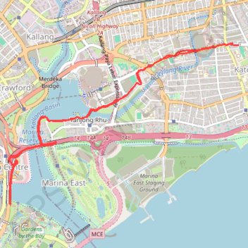
Name: Morning Run trail, distance, elevation, map, profile, GPS track
Coordinates: 1.28531 103.86165 1.30960 103.89637
Other hiking, mountain biking, running and outdoor activity trails
Click on a trail to view its statistics, map and profile.
Singapore East Coast Park
Distance: 7.8 mi • Elevation gain: 79 m • Maximum elevation: 22 m
Directions from Duck Tour Ramp to Marina Boulevard, Singapore
Distance: 65.5 mi • Elevation gain: 812 m • Maximum elevation: 51 m
Marina Parade -> Haji Lane
Distance: 5.8 mi • Elevation gain: 47 m • Maximum elevation: 19 m