Import a GPX file

Sydney

#Hiking #Loop #Sydney

  • Distance: 9.2 mi
  • Elevation gain: 428 m
  • Maximum elevation: 82 m
  • Elevation loss: 428 m
  • Minimum elevation: 0 m

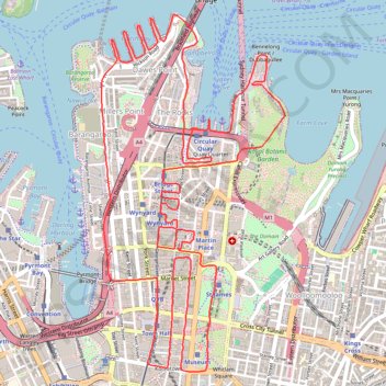
Interactive trail map

Trail profile

  • Distance: 9.2 mi
  • Elevation gain: 428 m
  • Maximum elevation: 82 m
  • Elevation loss: 428 m
  • Minimum elevation: 0 m

About this trail

Other hiking, mountain biking, running and outdoor activity trails

Click on a trail to view its statistics, map and profile.

Royal Botanic Park - Sydney

Australia > New South Wales > Sydney

#Hiking #Loop

Distance: 8.8 mi • Elevation gain: 399 m • Maximum elevation: 68 m

Centennial Park - Sydney

Australia > New South Wales > Sydney

#Bike #Centennial #Sydney

Distance: 18.3 mi • Elevation gain: 272 m • Maximum elevation: 74 m

Sydney Sightseer

Australia > New South Wales > Sydney

#Bike #Loop #Sydney

Distance: 32.5 mi • Elevation gain: 823 m • Maximum elevation: 93 m

Sydney to Oran Park NSW

Australia > New South Wales > Sydney

Distance: 37.5 mi • Elevation gain: 577 m • Maximum elevation: 126 m

Gear up for your next adventure:

🧭Orienteering Compasses - Accurate compasses for map-based navigation
🚲Bikepacking Frame Bags - Storage for tools and navigation gear on long off-road rides
Lightweight Tents - Compact tents for backpacking and trekking
🧭Professional Hiking Compasses - High-precision liquid-filled compasses for map reading and orientation
🗺️Topographic Maps - Detailed maps showing elevation and terrain features

As an Amazon Associate, this site earns from qualifying purchases at no extra cost to you.