Bardon trails
Brisbane Trail Run
- Distance: 8.3 mi
- Elevation gain: 422 m
- Maximum elevation: 171 m
- Elevation loss: 422 m
- Minimum elevation: 42 m
- Moving time: 1 h 43 m
- Moving speed: 4.8 mph
- Maximum speed: 10.1 mph
- Total time: 2 h 10 s
- Global speed: 4.1 mph
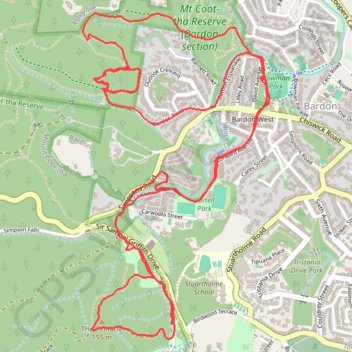
Interactive trail map
Trail profile
- Distance: 8.3 mi
- Elevation gain: 422 m
- Maximum elevation: 171 m
- Elevation loss: 422 m
- Minimum elevation: 42 m
- Moving time: 1 h 43 m
- Moving speed: 4.8 mph
- Maximum speed: 10.1 mph
- Total time: 2 h 10 s
- Global speed: 4.1 mph
About this trail
Name: Bardon trails trail, distance, elevation, map, profile, GPS track
Coordinates: -27.47167 152.96523 -27.45390 152.97672
Other hiking, mountain biking, running and outdoor activity trails
Click on a trail to view its statistics, map and profile.
Mount Coot-Tha trails
Brisbane Trail Run
Distance: 14.5 mi • Elevation gain: 842 m • Maximum elevation: 261 m