Import a GPX file

CootTha trails

Click on a trail to view its statistics, map and profile.

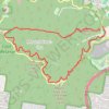
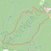
Mount Coot-tha Loop

Australia > Queensland

Mount Coot-tha Reserve. #Hiking #Loop #CootTha

Distance: 5.7 mi • Elevation gain: 253 m • Maximum elevation: 252 m

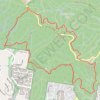
Mount Coot-tha Reserve

Australia > Queensland

#Hiking #Loop #CootTha

Distance: 6.0 mi • Elevation gain: 432 m • Maximum elevation: 252 m

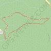
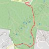
Mount Coot-tha - Reservoir Trail - Honeyeater Track

Australia > Queensland

Mount Coot-tha Reserve. #Hiking #Loop #CootTha

Distance: 1.1 mi • Elevation gain: 100 m • Maximum elevation: 225 m

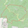
Mount Coot-tha Reserve

Australia > Queensland

Kokoda Track, Powerful Owl Trail and Summit Track. #Hiking #Loop #CootTha

Distance: 5.2 mi • Elevation gain: 375 m • Maximum elevation: 248 m

Jacksonia Track - Cockatoo Trail - Bellbird Trail - Kokoda Track

Australia > Queensland

Mount Coot-tha Reserve. #Hiking #Loop #CootTha

Distance: 2.6 mi • Elevation gain: 203 m • Maximum elevation: 246 m

Mount Coot-tha Lookout Trail

Australia > Queensland

#Hiking #CootTha

Distance: 2.1 mi • Elevation gain: 187 m • Maximum elevation: 221 m

Gear up for your next adventure:

🧣Fleece Neck Warmers - Extra insulation for winter topographic surveys
📷Camera Straps - Secure straps for carrying cameras while walking
🧴Sport Sunscreen Sticks - High-protection sunblock that won't run into your eyes on the trail
🎒Hiking Child Carriers - Explore the outdoors with the whole family safely
👟Men's Trail Running Shoes - Lightweight grip for fast movement over topographic contours

As an Amazon Associate, this site earns from qualifying purchases at no extra cost to you.