Regent's Park and Hyde Park Loop
Interactive trail map
Trail profile
- Distance: 9.1 mi
- Elevation gain: 117 m
- Maximum elevation: 53 m
- Elevation loss: 118 m
- Minimum elevation: 14 m
About this trail
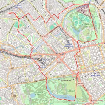
Name: Regent's Park and Hyde Park Loop trail, distance, elevation, map, profile, GPS track
Coordinates: 51.50387 -0.19713 51.53749 -0.14761
Topography: London topographic map, elevation, terrain
Other hiking, mountain biking, running and outdoor activity trails
Click on a trail to view its statistics, map and profile.
2014-07-29 06:09:07 Auto
United Kingdom > England > London
Distance: 37.8 mi • Elevation gain: 307 m • Maximum elevation: 38 m
Night Run
United Kingdom > England > London
Distance: 6.8 mi • Elevation gain: 73 m • Maximum elevation: 42 m