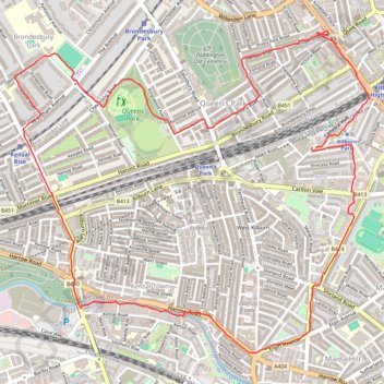
Queen's Park Loop
Interactive trail map
Trail profile
- Distance: 5.1 mi
- Elevation gain: 56 m
- Maximum elevation: 61 m
- Elevation loss: 57 m
- Minimum elevation: 25 m
- Moving time: 1 h 18 m
- Moving speed: 3.9 mph
- Maximum speed: 15.3 mph
- Total time: 1 h 30 m
- Global speed: 3.3 mph
About this trail
Name: Queen's Park Loop trail, distance, elevation, map, profile, GPS track
Coordinates: 51.52436 -0.22051 51.54011 -0.19257
Topography: London topographic map, elevation, terrain
Other hiking, mountain biking, running and outdoor activity trails
Click on a trail to view its statistics, map and profile.
2014-07-29 06:09:07 Auto
United Kingdom > England > London
Distance: 37.8 mi • Elevation gain: 307 m • Maximum elevation: 38 m