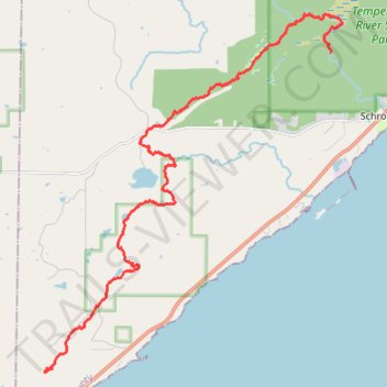
USA MN SHT - Crystal Creek Campsite to South Cross River Campsite
- Distance: 12.4 mi
- Elevation gain: 355 m
- Maximum elevation: 432 m
- Elevation loss: 306 m
- Minimum elevation: 287 m
- Moving time: 8 h 11 m
- Moving speed: 1.5 mph
- Maximum speed: 3.1 mph
- Total time: 9 h 28 m
- Global speed: 1.3 mph
Interactive trail map
Trail profile
- Distance: 12.4 mi
- Elevation gain: 355 m
- Maximum elevation: 432 m
- Elevation loss: 306 m
- Minimum elevation: 287 m
- Moving time: 8 h 11 m
- Moving speed: 1.5 mph
- Maximum speed: 3.1 mph
- Total time: 9 h 28 m
- Global speed: 1.3 mph
About this trail
Name: USA MN SHT - Crystal Creek Campsite to South Cross River Campsite trail, distance, elevation, map, profile, GPS track
Start: Crystal Creek Camp, Schroeder Township, Cook County, Minnesota, United States (47.48354 -91.01256)
Coordinates: 47.48261 -91.01549 47.56674 -90.91191
Other hiking, mountain biking, running and outdoor activity trails
Click on a trail to view its statistics, map and profile.
USA MN SHT - South Cross River Campsite to Britton Peak Trailhead
United States > Minnesota > Cook County > Schroeder Township
Distance: 7.8 mi • Elevation gain: 391 m • Maximum elevation: 439 m
USA MN SHT - Manitou State Park to Crystal Creek Campsite
United States > Minnesota > Lake County > Lake No. 1
Distance: 8.2 mi • Elevation gain: 326 m • Maximum elevation: 491 m