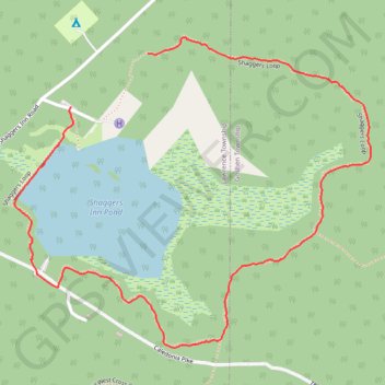
Shaggers Inn Pond Loop
- Distance: 1.7 mi
- Elevation gain: 27 m
- Maximum elevation: 617 m
- Elevation loss: 30 m
- Minimum elevation: 594 m
- Moving time: 39 m 4 s
- Moving speed: 2.7 mph
- Maximum speed: 5.3 mph
- Total time: 44 m 16 s
- Global speed: 2.4 mph
Interactive trail map
Trail profile
- Distance: 1.7 mi
- Elevation gain: 27 m
- Maximum elevation: 617 m
- Elevation loss: 30 m
- Minimum elevation: 594 m
- Moving time: 39 m 4 s
- Moving speed: 2.7 mph
- Maximum speed: 5.3 mph
- Total time: 44 m 16 s
- Global speed: 2.4 mph
About this trail
Name: Shaggers Inn Pond Loop trail, distance, elevation, map, profile, GPS track
Coordinates: 41.19879 -78.42201 41.20624 -78.41065
Other hiking, mountain biking, running and outdoor activity trails
Click on a trail to view its statistics, map and profile.