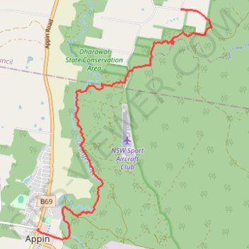
Appin - Minerva pool - Wedderburn
Interactive trail map
Trail profile
- Distance: 7.2 mi
- Elevation gain: 220 m
- Maximum elevation: 281 m
- Elevation loss: 195 m
- Minimum elevation: 199 m
About this trail
Name: Appin - Minerva pool - Wedderburn trail, distance, elevation, map, profile, GPS track
Coordinates: -34.20335 150.78733 -34.15603 150.83041
Other hiking, mountain biking, running and outdoor activity trails
Click on a trail to view its statistics, map and profile.
Appin Falls
Australia > New South Wales > Appin
Distance: 8.8 mi • Elevation gain: 154 m • Maximum elevation: 296 m