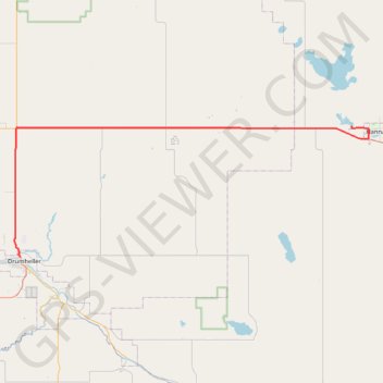
Drumheller - Hanna
#Bike #Drumheller #Hanna
- Distance: 48.9 mi
- Elevation gain: 439 m
- Maximum elevation: 914 m
- Elevation loss: 310 m
- Minimum elevation: 684 m
Interactive trail map
Trail profile
- Distance: 48.9 mi
- Elevation gain: 439 m
- Maximum elevation: 914 m
- Elevation loss: 310 m
- Minimum elevation: 684 m
About this trail
Name: Drumheller - Hanna trail, distance, elevation, map, profile, GPS track
Start: Bridge Street, North Drumheller, Drumheller, Alberta, T0J 0Y2, Canada (51.47146 -112.71225)
End: Township Road 312, Special Area No. 2, Alberta, Canada (51.65198 -111.97966)
Coordinates: 51.47146 -112.72569 51.65198 -111.94204
Other hiking, mountain biking, running and outdoor activity trails
Click on a trail to view its statistics, map and profile.