Port Jervis Watershed
- Distance: 29.3 mi
- Elevation gain: 919 m
- Maximum elevation: 343 m
- Elevation loss: 920 m
- Minimum elevation: 161 m
- Moving time: 4 h 54 m
- Moving speed: 6.0 mph
- Maximum speed: 17.4 mph
- Total time: 5 h 11 m
- Global speed: 5.6 mph
Interactive trail map
Trail profile
- Distance: 29.3 mi
- Elevation gain: 919 m
- Maximum elevation: 343 m
- Elevation loss: 920 m
- Minimum elevation: 161 m
- Moving time: 4 h 54 m
- Moving speed: 6.0 mph
- Maximum speed: 17.4 mph
- Total time: 5 h 11 m
- Global speed: 5.6 mph
About this trail
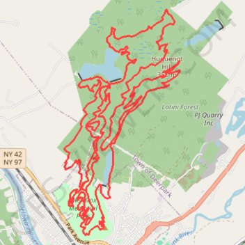
Name: Port Jervis Watershed trail, distance, elevation, map, profile, GPS track
Coordinates: 41.37995 -74.70091 41.42345 -74.67088
Other hiking, mountain biking, running and outdoor activity trails
Click on a trail to view its statistics, map and profile.
Port Jervis Watershed / Elks-Brox Memorial Park
United States > New York > Orange County > City of Port Jervis
Distance: 4.0 mi • Elevation gain: 162 m • Maximum elevation: 289 m
Port Jervis Watershed and Recreation Area
United States > New York > Orange County
Distance: 12.3 mi • Elevation gain: 277 m • Maximum elevation: 375 m