Import a GPX file

Mount Macedon - Camels Hump

Macedon Regional Park. #Hiking #Macedon

  • Distance: 10.0 mi
  • Elevation gain: 400 m
  • Maximum elevation: 990 m
  • Elevation loss: 400 m
  • Minimum elevation: 874 m

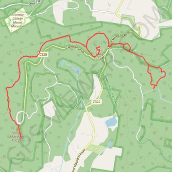
Interactive trail map

Trail profile

  • Distance: 10.0 mi
  • Elevation gain: 400 m
  • Maximum elevation: 990 m
  • Elevation loss: 400 m
  • Minimum elevation: 874 m

About this trail

Other hiking, mountain biking, running and outdoor activity trails

Click on a trail to view its statistics, map and profile.

Macedon Ranges Walking Trail - Mount Macedon

Australia > Victoria > Woodend

Macedon Regional Park. #Hiking #Loop #Macedon

Distance: 4.9 mi • Elevation gain: 432 m • Maximum elevation: 990 m

Mount Macedon

Australia > Victoria > Macedon

Macedon Regional Park. #Hiking #Macedon

Distance: 3.4 mi • Elevation gain: 540 m • Maximum elevation: 985 m

Macedon ranges walking track

Australia > Victoria

Distance: 12.3 mi • Elevation gain: 731 m • Maximum elevation: 990 m

Gear up for your next adventure:

🧥Softshell Jackets - Breathable jackets for active outdoor use
🧼Technical Clothing Wash - Special soap to clean and restore waterproof membranes
🎒Hiking Child Carriers - Explore the outdoors with the whole family safely
📸Action Camera Chest Mounts - Record your ascent following topographic paths hands-free
🍳Camping Stoves - Compact stoves for outdoor cooking

As an Amazon Associate, this site earns from qualifying purchases at no extra cost to you.