7 Μαρ 2024 11:55:49 π.μ.
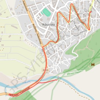
- Distance: 2.6 mi
- Elevation gain: 37 m
- Maximum elevation: 603 m
- Elevation loss: 187 m
- Minimum elevation: 439 m
- Moving time: 7 m 58 s
- Moving speed: 19.7 mph
- Maximum speed: 44.6 mph
- Total time: 7 m 58 s
- Global speed: 19.7 mph
Interactive trail map
Trail profile
- Distance: 2.6 mi
- Elevation gain: 37 m
- Maximum elevation: 603 m
- Elevation loss: 187 m
- Minimum elevation: 439 m
- Moving time: 7 m 58 s
- Moving speed: 19.7 mph
- Maximum speed: 44.6 mph
- Total time: 7 m 58 s
- Global speed: 19.7 mph
About this trail
Name: 7 Μαρ 2024 11:55:49 π.μ. trail, distance, elevation, map, profile, GPS track
Coordinates: 40.03374 20.73570 40.04730 20.75142