Discovering Newtyle Hill tracks by bicycle
- Distance: 6.4 mi
- Elevation gain: 330 m
- Maximum elevation: 281 m
- Elevation loss: 336 m
- Minimum elevation: 67 m
- Moving time: 1 h 20 m
- Moving speed: 4.8 mph
- Maximum speed: 24.2 mph
- Total time: 1 h 55 m
- Global speed: 3.4 mph
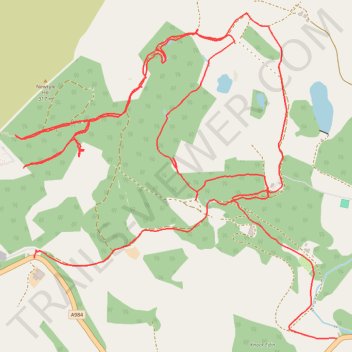
Interactive trail map
Trail profile
- Distance: 6.4 mi
- Elevation gain: 330 m
- Maximum elevation: 281 m
- Elevation loss: 336 m
- Minimum elevation: 67 m
- Moving time: 1 h 20 m
- Moving speed: 4.8 mph
- Maximum speed: 24.2 mph
- Total time: 1 h 55 m
- Global speed: 3.4 mph
About this trail
Name: Discovering Newtyle Hill tracks by bicycle trail, distance, elevation, map, profile, GPS track
Start: A984, Dunkeld, Perth and Kinross, Scotland, PH8 0HZ, United Kingdom (56.55130 -3.54850)
Coordinates: 56.54760 -3.55010 56.56254 -3.52333
Topography: Perth and Kinross topographic map, elevation, terrain
Other hiking, mountain biking, running and outdoor activity trails
Click on a trail to view its statistics, map and profile.
EMTB Gravel: Murthly - Birnam - Loop
United Kingdom > Scotland > Perth and Kinross > Newlands
Around Dunkeld, Perthshire Scotland
Distance: 28.8 mi • Elevation gain: 869 m • Maximum elevation: 305 m
Mountain Bike loop ride around Murthly, Perthshire Scotland
United Kingdom > Scotland > Perth and Kinross > Murthly > Gellyburn
UK, Perthshire, Dunkeld, Murthly
Distance: 11.2 mi • Elevation gain: 298 m • Maximum elevation: 178 m
Around Newtyle Hill, Dunkeld, Perthshire
United Kingdom > Scotland > Perth and Kinross
Distance: 17.5 mi • Elevation gain: 599 m • Maximum elevation: 278 m
Kinclaven Wood - Stanley - Bankfoot Loop
United Kingdom > Scotland > Perth and Kinross > Newlands
Distance: 26.7 mi • Elevation gain: 547 m • Maximum elevation: 137 m
Around Newtyle Hill near Dunkeld
United Kingdom > Scotland > Perth and Kinross > Clunie
Distance: 15.2 mi • Elevation gain: 594 m • Maximum elevation: 278 m