Foyle Valley Cycle Route
- Distance: 5.2 mi
- Elevation gain: 63 m
- Maximum elevation: 38 m
- Elevation loss: 32 m
- Minimum elevation: 0 m
Interactive trail map
Trail profile
- Distance: 5.2 mi
- Elevation gain: 63 m
- Maximum elevation: 38 m
- Elevation loss: 32 m
- Minimum elevation: 0 m
About this trail
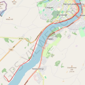
Name: Foyle Valley Cycle Route trail, distance, elevation, map, profile, GPS track
Coordinates: 54.95119 -7.39390 54.99834 -7.31365
Topography: Derry/Londonderry topographic map, elevation, terrain
Other hiking, mountain biking, running and outdoor activity trails
Click on a trail to view its statistics, map and profile.
CTS-N.Irelandv1.1-Belfast-Titanic>Enniscrone-via antrim coast-209miles
United Kingdom > Northern Ireland > County Down > Belfast
Distance: 208.7 mi • Elevation gain: 3,985 m • Maximum elevation: 271 m