Make a donation
Gear up for your next adventure:
As an Amazon Associate, this site earns from qualifying purchases at no extra cost to you.
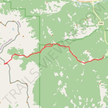
Fording River Pass Trail from Etherington Campground
- Distance: 19.1 mi
- Elevation gain: 1,068 m
- Maximum elevation: 2,321 m
- Elevation loss: 1,076 m
- Minimum elevation: 1,645 m
- Moving time: 6 h 7 m
- Moving speed: 3.1 mph
- Maximum speed: 7.0 mph
- Total time: 7 h 13 m
- Global speed: 2.6 mph
Interactive trail map
Make a donation
Gear up for your next adventure:
As an Amazon Associate, this site earns from qualifying purchases at no extra cost to you.
Trail profile
- Distance: 19.1 mi
- Elevation gain: 1,068 m
- Maximum elevation: 2,321 m
- Elevation loss: 1,076 m
- Minimum elevation: 1,645 m
- Moving time: 6 h 7 m
- Moving speed: 3.1 mph
- Maximum speed: 7.0 mph
- Total time: 7 h 13 m
- Global speed: 2.6 mph
Make a donation
Gear up for your next adventure:
As an Amazon Associate, this site earns from qualifying purchases at no extra cost to you.
About this trail
Name: Fording River Pass Trail from Etherington Campground trail, distance, elevation, map, profile, GPS track
Start: Kananaskis Improvement District, Alberta, Canada (50.32537 -114.63380)
End: Kananaskis Improvement District, Alberta, Canada (50.32797 -114.63313)
Coordinates: 50.31921 -114.79164 50.34000 -114.63266
Make a donation
Gear up for your next adventure:
As an Amazon Associate, this site earns from qualifying purchases at no extra cost to you.
Other hiking, mountain biking, running and outdoor activity trails
Click on a trail to view its statistics, map and profile.
Etherington Creek, Great Divide, Baril Creek, Baril Loop
Canada > Alberta > Kananaskis Improvement District
Distance: 13.7 mi • Elevation gain: 617 m • Maximum elevation: 2,073 m