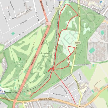
Run along paths in Banstead Common
- Distance: 3.4 mi
- Elevation gain: 75 m
- Maximum elevation: 150 m
- Elevation loss: 56 m
- Minimum elevation: 95 m
- Moving time: 38 m 38 s
- Moving speed: 5.3 mph
- Maximum speed: 10.7 mph
- Total time: 38 m 38 s
- Global speed: 5.3 mph
Interactive trail map
Trail profile
- Distance: 3.4 mi
- Elevation gain: 75 m
- Maximum elevation: 150 m
- Elevation loss: 56 m
- Minimum elevation: 95 m
- Moving time: 38 m 38 s
- Moving speed: 5.3 mph
- Maximum speed: 10.7 mph
- Total time: 38 m 38 s
- Global speed: 5.3 mph
About this trail
Name: Run along paths in Banstead Common trail, distance, elevation, map, profile, GPS track
Coordinates: 51.32736 -0.20628 51.34284 -0.19449
Topography: Reigate and Banstead topographic map, elevation, terrain