Import a GPX file

Inverclyde, Scotland, United Kingdom trails

Click on a trail to view its statistics, map and profile.
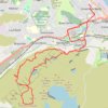
Dunrod Hill and Hillside Hill loop from Greenock West - Clyde Muirshiel Regional Park

United Kingdom > Scotland > Inverclyde > Greenock

Distance: 11.8 mi • Elevation gain: 410 m • Maximum elevation: 291 m
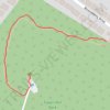
Tower Hill Park

United Kingdom > Scotland > Inverclyde > Gourock

Distance: 0.3 mi • Elevation gain: 55 m • Maximum elevation: 90 m

Gear up for your next adventure:

🥤Hiking Water Bottles - Reusable bottles for hydration on the trail
🛰️Handheld GPS Devices - Reliable GPS units for hiking and outdoor navigation
🧭Emergency Beacons - Safety beacons for remote outdoor locations
Lightweight Tents - Compact tents for backpacking and trekking
🧺Ultralight Dry Bags - Organize and waterproof your gear inside your rucksack

As an Amazon Associate, this site earns from qualifying purchases at no extra cost to you.