Import a GPX file

Inverclyde trails

Click on a trail to view its statistics, map and profile.
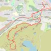
Dunrod Hill and Hillside Hill loop from Greenock West - Clyde Muirshiel Regional Park

United Kingdom > Scotland > Inverclyde > Greenock

Distance: 11.8 mi • Elevation gain: 410 m • Maximum elevation: 291 m
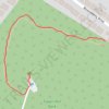
Tower Hill Park

United Kingdom > Scotland > Inverclyde > Gourock

Distance: 0.3 mi • Elevation gain: 55 m • Maximum elevation: 90 m

Other places

 •

Gear up for your next adventure:

🧊Personal Water Filters - Drink safely from mountain streams marked on your map
🥤Hydration Bladders - Hands-free hydration systems for backpacks
🧴Sport Sunscreen Sticks - High-protection sunblock that won't run into your eyes on the trail
🔦LED Camping Lanterns - Illumination for reading maps inside your tent at night
🗺️Ordnance Survey Maps - Official UK maps for walking and outdoor activities

As an Amazon Associate, this site earns from qualifying purchases at no extra cost to you.