Import a GPX file

Gander trails

Click on a trail to view its statistics, map and profile.
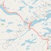
Gander - Mallorytown

Canada > Newfoundland and Labrador > Gander

#Bike #Gander #Mallorytown #Newfoundland

Distance: 62.9 mi • Elevation gain: 882 m • Maximum elevation: 146 m

Grand Falls-Windsor - Gander

Canada > Newfoundland and Labrador > Grand Falls-Windsor

#Bike #GrandFalls #Windsor #Gander #Newfoundland

Distance: 61.2 mi • Elevation gain: 699 m • Maximum elevation: 145 m

Gear up for your next adventure:

📐Altimeters & Barometers - Tools for measuring altitude and air pressure
📦Dry Bags - Waterproof bags to protect gear from rain
🧊Insulated Flasks - Keeps drinks hot or cold during hikes
🧢Waterproof Hiking Hats - Keep the rain off your face while studying topographic maps
🧤Waterproof Overmitts - Extreme weather protection for hikers and mountaineers

As an Amazon Associate, this site earns from qualifying purchases at no extra cost to you.