Import a GPX file

Forillon trails

Click on a trail to view its statistics, map and profile.
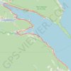
Gaspé - Saint-Georges-de-Malbaie

Canada > Quebec > La Côte-de-Gaspé > Gaspé > Cap-aux-Os > D'Aiguillon

Forillon National Park. Gulf of Saint Lawrence. #Bike #Gaspé #SaintGeorgesDeMalbaie #Forillon #SaintLawrence #Atlantic

Distance: 47.1 mi • Elevation gain: 796 m • Maximum elevation: 80 m

Gear up for your next adventure:

📱Rugged Phone Cases - Heavy-duty protection for smartphones used as secondary GPS tools
📐Altimeters & Barometers - Tools for measuring altitude and air pressure
👖Convertible Hiking Trousers - Versatile zip-off pants for changing mountain weather conditions
🥾Men's Waterproof Hiking Boots - Durable footwear with deep lugs for muddy and rocky UK terrains
🧤Waterproof Overmitts - Extreme weather protection for hikers and mountaineers

As an Amazon Associate, this site earns from qualifying purchases at no extra cost to you.