Import a GPX file

Boronia trails

Click on a trail to view its statistics, map and profile.

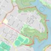
Hunters Hill - Boronia Park - Lane Cove River

Australia > New South Wales > Sydney

#Hiking #Loop #Boronia #Sydney

Distance: 2.7 mi • Elevation gain: 118 m • Maximum elevation: 49 m

Gear up for your next adventure:

🧗Locking Carabiners - Secure gear to your pack or for light technical use
🛰️Handheld GPS Devices - Reliable GPS units for hiking and outdoor navigation
🕶️Polarized Sunglasses - Reduces glare from snow and water when reading terrain
🚲Cycling GPS Computers - Track elevation and topographic routes on two wheels
👟Heavy Duty Boot Laces - Always carry a spare for your hiking footwear

As an Amazon Associate, this site earns from qualifying purchases at no extra cost to you.