Import a GPX file

Shawnigan Lake trails

Click on a trail to view its statistics, map and profile.
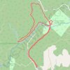
Kinsol Trestle Trail Recreation Site - Kinsol Bypass Trail

Canada > British Columbia > Cowichan Valley Regional District > Area B (Shawnigan Lake)

Vancouver Island. #Hiking #Loop #Kinsol #Vancouver

Distance: 3.8 mi • Elevation gain: 144 m • Maximum elevation: 151 m

Robertson River Falls dual sport ride (not BBF)

Canada > British Columbia > Cowichan Valley Regional District > Area B (Shawnigan Lake)

Full day dual sport loop, from Shawnigan to Robertson River Falls and back. Not BBF due to gates and Hillclimb.

Distance: 127.2 mi • Elevation gain: 5,260 m • Maximum elevation: 785 m
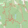
Fun enduro or dual sport tracks in the Oliphant area

Canada > British Columbia > Cowichan Valley Regional District > Area B (Shawnigan Lake)

Distance: 41.3 mi • Elevation gain: 2,391 m • Maximum elevation: 589 m
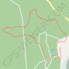
Solsante trails

Canada > British Columbia > Cowichan Valley Regional District > Area B (Shawnigan Lake)

Distance: 1.0 mi • Elevation gain: 52 m • Maximum elevation: 138 m

Gear up for your next adventure:

👕Merino Base Layers - Natural temperature regulation for cold weather hiking and camping
👟Women's Trail Running Shoes - Agile footwear for fell running and technical trails
💧Hydration Reservoirs - Convenient water bladders for hands-free drinking on the move
👖Packable Overtrousers - Quick-deploy rain protection for legs in sudden storms
🥄Titanium Camping Sporks - The ultimate lightweight utensil for trail meals

As an Amazon Associate, this site earns from qualifying purchases at no extra cost to you.