Import a GPX file

Menashe Regional Council trails

Click on a trail to view its statistics, map and profile.
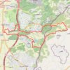
מסלול חדש ומטורף חוץ מקטע אחד

Israel > Haifa District > Menashe Regional Council > Givat Haviva

Distance: 14.4 mi • Elevation gain: 345 m • Maximum elevation: 183 m

Other places

Gear up for your next adventure:

🧤Thermal Touchscreen Gloves - Stay warm while operating your GPS or smartphone camera
📷Camera Straps - Secure straps for carrying cameras while walking
🗺️Topographic Maps - Detailed maps showing elevation and terrain features
🐕Dog Hiking Gear - Equipment for hiking safely with dogs
🧼Biodegradable Soap - Leave-no-trace hygiene for multi-day mountain treks

As an Amazon Associate, this site earns from qualifying purchases at no extra cost to you.