Import a GPX file

Totnes trails

Click on a trail to view its statistics, map and profile.
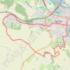
Totnes hike

United Kingdom > England > Devon > South Hams > Totnes > Dartington

Distance: 5.2 mi • Elevation gain: 243 m • Maximum elevation: 149 m

From Knowles Hill to Follaton

United Kingdom > England > Devon > South Hams > Totnes

Ebike ride

Distance: 34.6 mi • Elevation gain: 1,011 m • Maximum elevation: 123 m

Other places

Gear up for your next adventure:

❄️Walking Crampons - Added traction for icy slopes and winter peak bagging
📷Camera Straps - Secure straps for carrying cameras while walking
🧺Microfibre Travel Towels - Fast-drying and compact towels for wild swimming and camping
🦯Walking Poles - Supportive poles for long-distance walking
🧊Insulated Flasks - Keeps drinks hot or cold during hikes

As an Amazon Associate, this site earns from qualifying purchases at no extra cost to you.