Import a GPX file

Port Talbot trails

Click on a trail to view its statistics, map and profile.
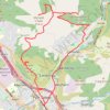
Mynydd Dinas, Mynydd Y Gaer and Foel Fynyddau Loop Walk

United Kingdom > Wales > Neath Port Talbot > Port Talbot

Distance: 11.3 mi • Elevation gain: 617 m • Maximum elevation: 370 m

Gear up for your next adventure:

🔦Keychain LED Torches - Emergency backup light for finding gear in your pack
⛺Lightweight Tents - Compact tents for backpacking and trekking
🛌Sleeping Mats - Insulated mats for comfortable outdoor sleeping
🗺️Topographic Maps - Detailed maps showing elevation and terrain features
🛰️Handheld GPS Devices - Reliable GPS units for hiking and outdoor navigation

As an Amazon Associate, this site earns from qualifying purchases at no extra cost to you.