Import a GPX file

Bogutovac trails

Click on a trail to view its statistics, map and profile.

Troglav 3 vrha

Serbia > Central Serbia > Raska Administrative District > Bogutovac

Distance: 10.1 mi • Elevation gain: 1,029 m • Maximum elevation: 1,152 m
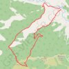
Trasa

Serbia > Central Serbia > Raska Administrative District > Bogutovac

Distance: 10.8 mi • Elevation gain: 1,055 m • Maximum elevation: 1,152 m

Gear up for your next adventure:

👟Waterproof Leg Gaiters - Keep mud and water out of your boots in boggy terrain
📷Outdoor Action Cameras - Cameras designed for hiking and adventure
📸Action Camera Chest Mounts - Record your ascent following topographic paths hands-free
🧣Fleece Neck Warmers - Extra insulation for winter topographic surveys
🧊Personal Water Filters - Drink safely from mountain streams marked on your map

As an Amazon Associate, this site earns from qualifying purchases at no extra cost to you.