Import a GPX file

Caryville trails

Click on a trail to view its statistics, map and profile.
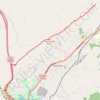
Cumberland Trail (CT) - Bruce Gap to Cumberland Mountain - Eagle Bluff

United States > Tennessee > Campbell County > Caryville

Distance: 8.9 mi • Elevation gain: 585 m • Maximum elevation: 645 m

Gear up for your next adventure:

🥫Expedition Meals - Lightweight, high-calorie nutrition for long-distance hikers
📍Handheld GPS Navigators - Reliable satellite navigation for hiking and off-road exploration
🔦Waterproof LED Headlamps - Hands-free lighting for evening treks and emergency navigation
🧭GPS Trackers - Tracking devices for safety and navigation
🧦Merino Wool Hiking Socks - Moisture-wicking socks to prevent blisters during long mountain walks

As an Amazon Associate, this site earns from qualifying purchases at no extra cost to you.