Import a GPX file

Campbell County trails

Click on a trail to view its statistics, map and profile.
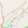
Cumberland Trail (CT) - Bruce Gap to Cumberland Mountain - Eagle Bluff

United States > Tennessee > Campbell County > Caryville

Distance: 8.9 mi • Elevation gain: 585 m • Maximum elevation: 645 m

Other places

Gear up for your next adventure:

🧴Tick Removal Tools - Small, essential health tool for UK woodland and moorland
🗺️Scratch-off Peak Maps - Track your progress climbing Munros or Wainwrights
🔦Waterproof LED Headlamps - Hands-free lighting for evening treks and emergency navigation
🚲Bikepacking Frame Bags - Storage for tools and navigation gear on long off-road rides
🍱Food Containers - Reusable containers for outdoor meals

As an Amazon Associate, this site earns from qualifying purchases at no extra cost to you.