Import a GPX file

Puslinch trails

Click on a trail to view its statistics, map and profile.
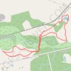
Fletchers Creek Ecological Preserve Loop

Canada > Ontario > Wellington County > Puslinch

Fletchers Creek Ecological Preserve. #Hiking #Running #Loop #FletchersCreek

Distance: 2.9 mi • Elevation gain: 19 m • Maximum elevation: 296 m

Gear up for your next adventure:

👕Merino Base Layers - Natural temperature regulation for cold weather hiking and camping
📢Survival Whistles - Essential safety gear for signaling for help in mountain fog
🥤Hiking Water Bottles - Reusable bottles for hydration on the trail
🗺️Topographic Maps - Detailed maps showing elevation and terrain features
☕Insulated Travel Mugs - Keep drinks hot while surveying the landscape from a summit

As an Amazon Associate, this site earns from qualifying purchases at no extra cost to you.