Import a GPX file

Elmbridge trails

Click on a trail to view its statistics, map and profile.
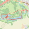
Painshill Loop

United Kingdom > England > Surrey > Elmbridge > Cobham

Loop hike from Cobham via River Mole, The Lake, Woollett Bidge, Grotto Island, Crystal Grotto and Five Arch Bridge. #Hiking #Loop #Nature #River #Lake #Forest #Cave

Distance: 2.3 mi • Elevation gain: 29 m • Maximum elevation: 33 m

Esher wander

United Kingdom > England > Surrey > Elmbridge > Esher

Distance: 1.1 mi • Elevation gain: 15 m • Maximum elevation: 46 m

Other places

 •

Gear up for your next adventure:

🔋Rechargeable Batteries - Eco-friendly power for headlamps and older GPS units
🧼Biodegradable Soap - Leave-no-trace hygiene for multi-day mountain treks
📍Handheld GPS Navigators - Reliable satellite navigation for hiking and off-road exploration
🧺Microfibre Travel Towels - Fast-drying and compact towels for wild swimming and camping
🖼️Topographic Map Art - Decorative 3D-effect posters of famous UK peaks and regions

As an Amazon Associate, this site earns from qualifying purchases at no extra cost to you.