Import a GPX file

Wawa trails

Click on a trail to view its statistics, map and profile.
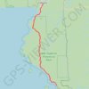
Wawa - Lake Superior Provincial Park

Canada > Ontario > Algoma District > Wawa

#Bike #Wawa #LakeSuperior

Distance: 55.5 mi • Elevation gain: 890 m • Maximum elevation: 408 m
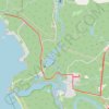
Ride from Sandy Beach

Canada > Ontario > Algoma District > Wawa

Distance: 4.5 mi • Elevation gain: 139 m • Maximum elevation: 247 m

Gear up for your next adventure:

🚶Walking Pedometers - Simple distance tracking for casual trail walkers
⌚GPS Outdoor Watches - Watches with GPS tracking for hiking and exploration
📷Camera Straps - Secure straps for carrying cameras while walking
🔦Head Torches - Hands-free lighting for hiking and camping
🗺️Ordnance Survey Maps - Essential paper maps for hiking across the UK national parks

As an Amazon Associate, this site earns from qualifying purchases at no extra cost to you.