Import a GPX file

Danville trails

Click on a trail to view its statistics, map and profile.
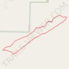
Danville Mountain Trail (Upper Loop, Extended) in Ouachita National Forest

United States > Arkansas > Yell County > Danville

Distance: 2.7 mi • Elevation gain: 146 m • Maximum elevation: 326 m
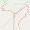
Danville Mountain Trail (Lower Section) in Ouachita National Forest

United States > Arkansas > Yell County > Danville

Distance: 1.3 mi • Elevation gain: 118 m • Maximum elevation: 225 m

Gear up for your next adventure:

🔭Compact Hiking Binoculars - Lightweight optics for scouting terrain and spotting wildlife
🧦Hiking Socks - Breathable socks designed to prevent blisters on long walks
📦Compression Sacks - Reduce backpack volume efficiently
🛌Sleeping Bags - Warm and packable sleeping bags for outdoor nights
🧤Hiking Gloves - Warm and durable gloves for cold-weather walks

As an Amazon Associate, this site earns from qualifying purchases at no extra cost to you.