
Timberlea trails
Click on a trail to view its statistics, map and profile.
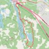
Cranberry Lake and Pot Lake via Bluff Wilderness Trail
Canada > Nova Scotia > Halifax County > Timberlea
Five Bridge Lakes Wilderness Area. #Hiking #Snowshoeing #Loop #FiveBridgeLakes
Distance: 4.6 mi • Elevation gain: 93 m • Maximum elevation: 128 m
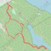
Charlies Lake
Canada > Nova Scotia > Halifax County > Timberlea
Distance: 2.3 mi • Elevation gain: 78 m • Maximum elevation: 107 m
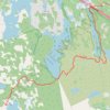
Bluff Wilderness Trails - Hay Marsh Loop
Canada > Nova Scotia > Halifax County > Timberlea
Distance: 6.7 mi • Elevation gain: 139 m • Maximum elevation: 116 m