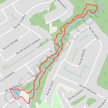
Rivière des Roches Loop
#Hiking #Running #Snowshoeing #Loop
- Distance: 1.4 mi
- Elevation gain: 35 m
- Maximum elevation: 196 m
- Elevation loss: 35 m
- Minimum elevation: 162 m
Interactive trail map
Trail profile
- Distance: 1.4 mi
- Elevation gain: 35 m
- Maximum elevation: 196 m
- Elevation loss: 35 m
- Minimum elevation: 162 m
About this trail
Name: Rivière des Roches Loop trail, distance, elevation, map, profile, GPS track
Coordinates: 46.89352 -71.29198 46.89959 -71.28424