The County Half Marathon
Interactive trail map
Trail profile
- Distance: 13.1 mi
- Elevation gain: 78 m
- Maximum elevation: 114 m
- Elevation loss: 78 m
- Minimum elevation: 82 m
About this trail
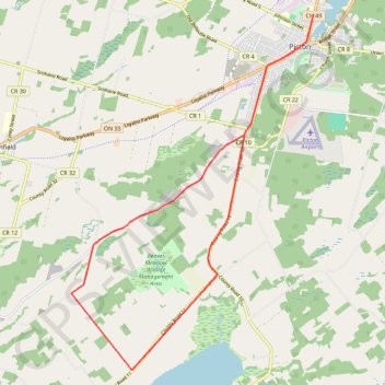
Name: The County Half Marathon trail, distance, elevation, map, profile, GPS track
Coordinates: 43.93867 -77.20875 44.01456 -77.13698
Other hiking, mountain biking, running and outdoor activity trails
Click on a trail to view its statistics, map and profile.
Cobourg - Adolphustown
Canada > Ontario > Northumberland County > Cobourg
Lake Ontario. #Bike #Cobourg #Adolphustown #Ontario
Distance: 71.0 mi • Elevation gain: 449 m • Maximum elevation: 119 m