Import a GPX file

Bronson Forest MTB Loop via an old windmill

Mountain Bike loop in Charles H. Bronson State Forest. #MTB #Loop #Forest #Nature

  • Distance: 5.6 mi
  • Elevation gain: 20 m
  • Maximum elevation: 17 m
  • Elevation loss: 20 m
  • Minimum elevation: 6 m
  • Moving time: 47 m 41 s
  • Moving speed: 7.0 mph
  • Maximum speed: 16.1 mph
  • Total time: 1 h 24 m
  • Global speed: 3.9 mph

Interactive trail map

Trail profile

  • Distance: 5.6 mi
  • Elevation gain: 20 m
  • Maximum elevation: 17 m
  • Elevation loss: 20 m
  • Minimum elevation: 6 m
  • Moving time: 47 m 41 s
  • Moving speed: 7.0 mph
  • Maximum speed: 16.1 mph
  • Total time: 1 h 24 m
  • Global speed: 3.9 mph

About this trail

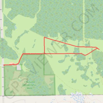
Name: Bronson Forest MTB Loop via an old windmill trail, distance, elevation, map, profile, GPS track

Start: Florida Trail, Seminole County, Florida, United States (28.62347 -81.06307)

End: Florida Trail, Seminole County, Florida, United States (28.62341 -81.06310)

Coordinates: 28.62341 -81.06326 28.63344 -81.02521

Gear up for your next adventure:

Camping Shelters - Emergency and lightweight shelters for outdoor use
🚲Cycling GPS Computers - Track elevation and topographic routes on two wheels
👖Convertible Hiking Trousers - Versatile zip-off pants for changing mountain weather conditions
🧤Hiking Gloves - Warm and durable gloves for cold-weather walks
🔦Keychain LED Torches - Emergency backup light for finding gear in your pack

As an Amazon Associate, this site earns from qualifying purchases at no extra cost to you.