Make a donation
Gear up for your next adventure:
As an Amazon Associate, this site earns from qualifying purchases at no extra cost to you.
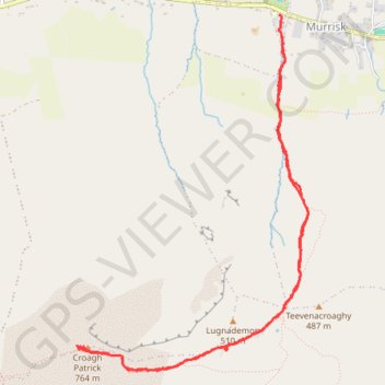
Croagh Patrick
- Distance: 4.8 mi
- Elevation gain: 740 m
- Maximum elevation: 757 m
- Elevation loss: 732 m
- Minimum elevation: 16 m
- Moving time: 2 h 52 m
- Moving speed: 1.7 mph
- Maximum speed: 4.3 mph
- Total time: 4 h 16 m
- Global speed: 1.1 mph
Interactive trail map
Make a donation
Gear up for your next adventure:
As an Amazon Associate, this site earns from qualifying purchases at no extra cost to you.
Trail profile
- Distance: 4.8 mi
- Elevation gain: 740 m
- Maximum elevation: 757 m
- Elevation loss: 732 m
- Minimum elevation: 16 m
- Moving time: 2 h 52 m
- Moving speed: 1.7 mph
- Maximum speed: 4.3 mph
- Total time: 4 h 16 m
- Global speed: 1.1 mph
Make a donation
Gear up for your next adventure:
As an Amazon Associate, this site earns from qualifying purchases at no extra cost to you.
About this trail
Name: Croagh Patrick trail, distance, elevation, map, profile, GPS track
Coordinates: 53.75867 -9.66025 53.77971 -9.63709
Make a donation
Gear up for your next adventure:
As an Amazon Associate, this site earns from qualifying purchases at no extra cost to you.
Other hiking, mountain biking, running and outdoor activity trails
Click on a trail to view its statistics, map and profile.
Connemara - Day 1
Ireland > County Galway > Leenaun
#Bike
Distance: 38.6 mi • Elevation gain: 651 m • Maximum elevation: 76 m
New path on Croagh Patrick
County Mayo Walking
Distance: 2.3 mi • Elevation gain: 739 m • Maximum elevation: 756 m
Croagh Patrick Hike
Ireland > County Mayo > Murrisk
Distance: 4.5 mi • Elevation gain: 725 m • Maximum elevation: 757 m