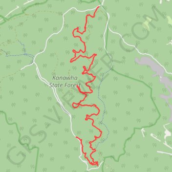
Middle Ridge Trail - Kanawha State Forest
hiking, trail
- Distance: 11.2 mi
- Elevation gain: 604 m
- Maximum elevation: 459 m
- Elevation loss: 505 m
- Minimum elevation: 227 m
- Moving time: 33 m 31 s
- Moving speed: 20.0 mph
- Maximum speed: 28.1 mph
- Total time: 33 m 31 s
- Global speed: 20.0 mph
Interactive trail map
Trail profile
- Distance: 11.2 mi
- Elevation gain: 604 m
- Maximum elevation: 459 m
- Elevation loss: 505 m
- Minimum elevation: 227 m
- Moving time: 33 m 31 s
- Moving speed: 20.0 mph
- Maximum speed: 28.1 mph
- Total time: 33 m 31 s
- Global speed: 20.0 mph
About this trail
Name: Middle Ridge Trail - Kanawha State Forest trail, distance, elevation, map, profile, GPS track
Start: Davis Creek Trail, Kanawha County, West Virginia, 25364, United States (38.28082 -81.64257)
Coordinates: 38.22803 -81.65464 38.28082 -81.64156