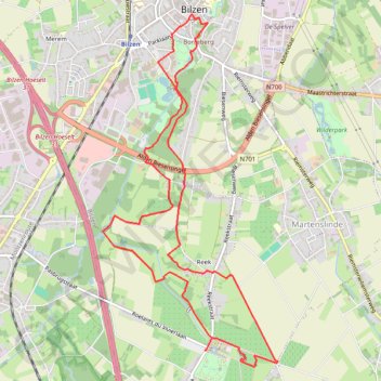
Greenspot Alden Biesen, startplaats De Kimpel (rood)
- Distance: 6.6 mi
- Elevation gain: 133 m
- Maximum elevation: 109 m
- Elevation loss: 133 m
- Minimum elevation: 53 m
Interactive trail map
Trail profile
- Distance: 6.6 mi
- Elevation gain: 133 m
- Maximum elevation: 109 m
- Elevation loss: 133 m
- Minimum elevation: 53 m
About this trail
Name: Greenspot Alden Biesen, startplaats De Kimpel (rood) trail, distance, elevation, map, profile, GPS track
Coordinates: 50.84025 5.50579 50.87032 5.52944
Other hiking, mountain biking, running and outdoor activity trails
Click on a trail to view its statistics, map and profile.
Riethoven naar Oostenrijk
Netherlands > North Brabant > Riethoven > Eind
Distance: 573.0 mi • Elevation gain: 13,629 m • Maximum elevation: 1,897 m
Eurovelo 15 - Strasbourg Rotterdam
France > Grand Est > Bas-Rhin > Strasbourg
Distance: 554.1 mi • Elevation gain: 2,104 m • Maximum elevation: 146 m