Bondcliff
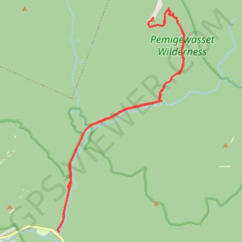
Hike from Lincoln Woods Trailhead to Bondcliff via East Branch Pemigewasset River, Lincoln Woods Trail and Bondcliff Trail in the Pemigewasset Wilderness. #Hiking #Mountain #Nature #Forest #River #Wilderness
- Distance: 18.0 mi
- Elevation gain: 1,002 m
- Maximum elevation: 1,281 m
- Elevation loss: 1,002 m
- Minimum elevation: 353 m
- Moving time: 8 h 3 m
- Moving speed: 2.2 mph
- Maximum speed: 4.9 mph
- Total time: 8 h 53 m
- Global speed: 2.0 mph
Interactive trail map
Trail profile
- Distance: 18.0 mi
- Elevation gain: 1,002 m
- Maximum elevation: 1,281 m
- Elevation loss: 1,002 m
- Minimum elevation: 353 m
- Moving time: 8 h 3 m
- Moving speed: 2.2 mph
- Maximum speed: 4.9 mph
- Total time: 8 h 53 m
- Global speed: 2.0 mph
About this trail
Name: Bondcliff trail, distance, elevation, map, profile, GPS track
Coordinates: 44.06376 -71.58863 44.14421 -71.52496
Other hiking, mountain biking, running and outdoor activity trails
Click on a trail to view its statistics, map and profile.