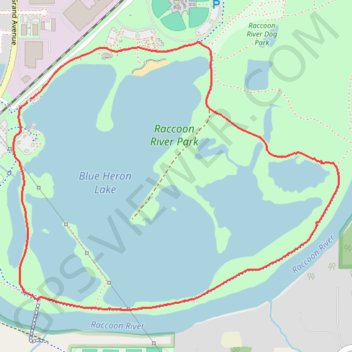
Blue Heron Lake Loop via Raccoon River Park Trail
The Blue Heron Lake Loop offers a peaceful, scenic hike around a lake, featuring views of both water and wetlands. With mostly flat terrain and sections of the path shaded by trees, it’s a popular spot for hikers, joggers, and families, providing accessibility for people of all skill levels. Along the route, you’ll find viewpoints across Blue Heron Lake, a diverse array of birdlife, and occasional views of the nearby Raccoon River, making it a beautiful nature escape close to urban Des Moines. #Hiking #Loop #Lake #Forest #Nature
- Distance: 3.1 mi
- Elevation gain: 17 m
- Maximum elevation: 251 m
- Elevation loss: 17 m
- Minimum elevation: 242 m
- Moving time: 1 h 9 m
- Moving speed: 2.7 mph
- Maximum speed: 3.6 mph
- Total time: 1 h 11 m
- Global speed: 2.6 mph
Interactive trail map
Trail profile
- Distance: 3.1 mi
- Elevation gain: 17 m
- Maximum elevation: 251 m
- Elevation loss: 17 m
- Minimum elevation: 242 m
- Moving time: 1 h 9 m
- Moving speed: 2.7 mph
- Maximum speed: 3.6 mph
- Total time: 1 h 11 m
- Global speed: 2.6 mph
About this trail
Name: Blue Heron Lake Loop via Raccoon River Park Trail trail, distance, elevation, map, profile, GPS track
Coordinates: 41.54277 -93.73701 41.55471 -93.71758